Hurricane Milton strengthened as it churned through the Gulf of Mexico toward Florida on Tuesday and could wallop one of the state’s major population centers with huge storm surges, lashing rain and destructive winds just two weeks after deadly Hurricane Helene swamped the coastline.
Milton, which returned to Category 5 status on Tuesday afternoon, is threatening the Tampa Bay area, which is home to more than 3.3 million people and has managed to evade a direct hit from a major hurricane for more than 100 years. Milton is also menacing other stretches of Florida’s west coast that were battered when Helene came ashore on Sept. 26.
Traffic was thick Tuesday as people fled the Tampa area ahead of Milton. As they evacuated, crews along the coast hurried to clear Helene’s debris so that Milton doesn’t turn it into dangerous projectiles.
National Hurricane Center forecasters warned that Milton is “expected to be a dangerous major hurricane” when it reaches the Florida coast.
Follow The Associated Press’ coverage of tropical weather at https://apnews.com/hub/weather.
When will Milton make landfall and how strong will it be?
Milton is expected to make landfall on Florida’s central Gulf coast late Wednesday.
“We must be prepared for a major, major impact to the west coast of Florida,” Florida Gov. Ron DeSantis said Tuesday.
As of late Tuesday afternoon, the storm was about 480 miles (775 kilometers) southwest of Tampa with sustained winds of 165 mph (270 kph).
President Joe Biden, who postponed an overseas trip so he could remain at the White House to monitor Milton, warned that it “could be one of the worst storms in 100 years to hit Florida.”
With the storm expected to remain fairly strong as it crosses Florida, hurricane warnings were extended early Tuesday to parts of the state’s east coast.
Why are scientists saying this is a weird storm season?
Milton is just the latest system in a storm season that scientists say is the weirdest they’ve ever seen.
Forecasters were predicting a busy Atlantic hurricane season before it started, and it began when Beryl became the earliest storm on record to reach Category 5 status. But from Aug. 20 — the traditional start of peak hurricane season — to Sept. 23 it was record quiet, said Colorado State University hurricane researcher Phil Klotzbach.
Then, five hurricanes popped up between Sept. 26 and Oct. 6, more than double the old record of two. On Sunday and Monday, there were three hurricanes in October at the same time, which had never happened before, Klotzbach said. In just 46.5 hours, Hurricane Milton went from forming as a tropical storm with 40 mph winds to a top-of-the-charts Category 5 hurricane.
With hurricanes disrupting the lives of millions in the U.S., some might wonder if it’s possible to control extreme weather events. But scientists say hurricanes are far too powerful for that, and climate change is providing more fuel than ever for storms like Helene and Milton
How bad is damage expected to be?
Florida’s Gulf Coast is especially vulnerable to storm surge.
Helene came ashore about 150 miles (240 kilometers) north of Tampa in the Florida Panhandle and still managed to cause drowning deaths in the Tampa area due to surges that were about 5 to 8 feet (1.5 to 2.5 meters) above normal tide levels.
With Milton, forecasters warn of a possible 10- to 15-foot (3- to 4.5-meter) storm surge in Tampa Bay. It is the highest surge ever predicted for that location and has led to evacuation orders for communities all along the coast.
The county that’s home to Tampa ordered areas adjacent to the bay and all mobile and manufactured homes to be evacuated by Tuesday night. With a predicted storm surge that could swallow a single-story house, Tampa Mayor Jane Castor issued increasingly dire warnings Tuesday to those planning to ride out the storm: “So if you’re in it, basically that’s the coffin that you’re in.”
Milton is forecast to cross central Florida and dump as much as 18 inches (46 centimeters) of rain while heading toward the Atlantic Ocean, according to the hurricane center.
Is it difficult to get gas?
The hunt for gasoline has been compounding the stress for some Floridians.
On Tuesday, there were long lines and empty pumps at some Florida gas stations as they struggled to keep up with demand. DeSantis said state officials were working with fuel companies to continue bringing in gasoline ahead before the storm’s arrival.
Although DeSantis said there wasn’t a fuel shortage, the hunt for gasoline was another nerve-fraying task for people preparing for a major hurricane. Patrick De Haan, an analyst for GasBuddy, said “replenishments are happening,” but about 16.5% of Florida stations were out of fuel as of Tuesday afternoon. More than 43% of the stations in the Tampa-St. Petersburg area had no gasoline as of late Tuesday morning, according to GasBuddy.
“You’ve got to have patience,” Stephanie Grover-Brock, a Tampa resident in line for gasoline in the nearby Riverview area, said Tuesday.
Ned Bowman, a spokesman for the Florida Petroleum Marketers Association, said the situation was typical for a Florida hurricane — with demand peaking and some stations temporarily running dry. He said suppliers are “constantly” moving fuel to stations.
How was Mexico affected?
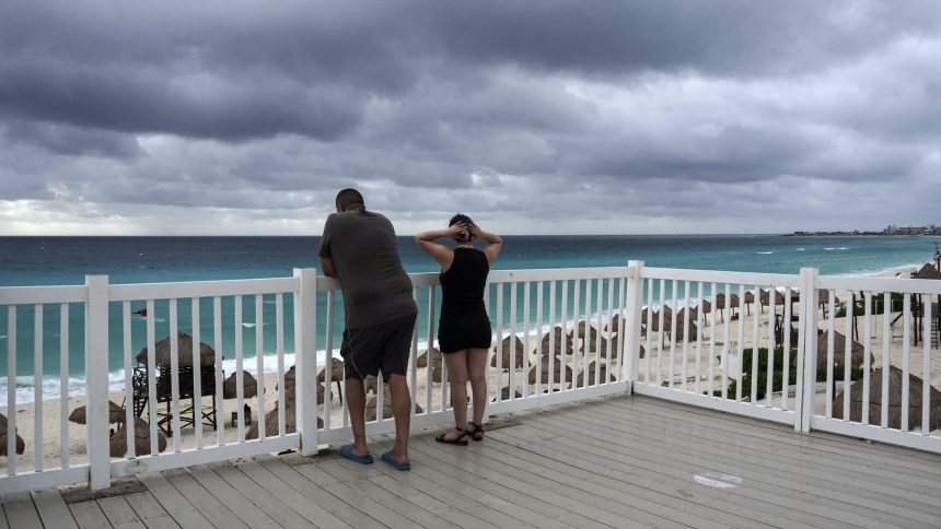
As Milton made it’s way toward Florida, authorities in the Mexican state of Yucatan reported only minor storm damage. Power lines, light poles and trees were knocked down near the coast, and some small thatched-roof structures were destroyed, according to Yucatan Gov. Joaquín Díaz. He did not report any deaths or injuries.
Read the full article here


